


4pm Wednesday, July 23, 2025
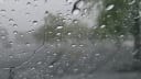
I first heard the term monster muggies from a mentor of mine in the late 1980s. He used it to describe the high humidity that often plagues the East Coast during the peak of the summer months, and that description certainly fit during the first three weeks of July here in Richmond.
We have gotten a welcome respite from the high humidity over the last day and a half, as our winds have turned from the northeast and east.
But this time of year, an airmass such as this one has a short lifespan over Virginia.
Although we will be in the upper 60s again on Thursday morning, we will begin a new string of nights above 70° on Friday morning — a string that will continue through this weekend and all of next week.

Below is a look back at how the heavy rain, high humidity, and the warming climate are all connected.
Heat and humidity are coming back
Temperature and humidity climb a bit on Thursday, and they soar again for Friday and this weekend. Those three days will bring afternoons well into the middle to upper 90s, with Saturday expected to be the hottest of the three — approaching 100.
With the higher humidity also returning, remember to hydrate and take breaks when outside this weekend, as the heat index will be up around 110 on Friday and the weekend — a quick path to heat exhaustion or heat stroke without proper precautions.
But unlike earlier this month, the thunderstorm chances will be much lower for the weekend and next week.
This reason is a subtle but important one.
For the first three weeks of July, winds aloft were often from the southwest, allowing moisture from deep into the atmosphere to move into Virginia to help spawn showers and drenching thunderstorms.
This weekend and next week, those winds will be more from the west and northwest, so the air aloft will be drier, and in some cases, warmer. This suppresses thunderstorm development, meaning it will certainly be drier during this final week of the month compared to the earlier weeks.

Afternoons next week will be in the 90s, and with scant chances for thunderstorms, expect local stream and creek flows to decrease and the James River level to fall below 5 feet.
You may even hear the phrase, “you know, we could actually use some rain,” before next weekend.

Looking specifically toward that weekend, there are encouraging signs for a late week round or two of showers and thunderstorms, followed by another substantial break in heat and humidity and dry weather for the weekend of August 2-3 — something with days in the 80s and nights in the 60s.
Over the summer hump
One statistic for those looking forward to fall: we have passed the climatologically hottest few days of the year, as normal high and low temperatures for each day are beginning to inch downward.
But afternoons averaging in the 70s will not return until the latter third of September.
Hurricanes? Not really
With the repeated thunderstorms earlier this month, there has been some talk in the grocery store lines about what that means for Virginia hurricane chances this year.
In reality, it does not mean anything. There is no physical evidence that heavy rain in July correlates with hurricanes arriving later in the year — so there is no way to know with any scientific confidence if Virginia will get a hurricane this year.
It may seem like it has been a slow season so far (3 named storms), but it is fairly typical to this point. The core of the hurricane season is from mid-August to mid-October, so prime hurricane season is still a few weeks away.
Science news 1
In case you missed it late last Friday, there was a massive layoff at the Environmental Protection Agency, as their Office of Research and Development is shutting down.
The announcement from the EPA public relations office said nothing about service to Americans in protection of the environment, it only boasted about how much it was saving (less than $1 billion).
EPA staff reduction since January has been 23 percent.
An engineering professor at N.C. State said it best, “Scientific integrity is out the window when the few remaining scientists lose their independence by being subordinated in policy offices or to the EPA administrator. A key reason for a separate Office of Research and Development was to protect the science from policy-oriented managerial biases and political interference. Scientific capability, capacity, and credibility are being lost.”
EPA administrator Lee Zeldin has repeatedly regurgitated conspiracy theories about condensation trails, which are nothing more than clouds that form as hot water vapor from jet exhaust condenses in the very cold upper atmosphere.

Frankly, the formation of condensation trails is something every meteorology student is taught in their first semester.
This suggests Zeldin’s understanding of the environment and his commitment to protecting it are both questionable at best.
Science News 2
More troubling was the Voyager Declaration released earlier this week, in which NASA scientists called out Interim Administrator Sean Duffy. The core of the declaration, signed by more than 500 current and former NASA scientists, reads:

“…the last six months have seen rapid and wasteful changes which have undermined our mission and caused catastrophic impacts on NASA's workforce. We are compelled to speak up when our leadership prioritizes political momentum over human safety, scientific advancement, and efficient use of public resources. These cuts are arbitrary and have been enacted in defiance of congressional appropriations law. The consequences for the agency and the country alike are dire.”
Anyone can support the NASA Voyager Declaration, and you can add your name via this link.
Finally, I was visiting my old school, Penn State, about week ago, and caught up with my friend Jon Nese, who put together this 3-minue description of the NOAA weather labs that are currently at risk of being dismantled — and why they are important.
Stay cool this weekend, everyone. The war on science continues to burn orange-hot.