


5:30pm Wednesday, June 4, 2025
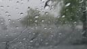
The precise details of the Thursday forecast are a challenge, as a large storm moving from North Carolina will make a run at Richmond on Thursday afternoon and evening. Rain will advance north to Petersburg and Williamsburg, but there is uncertainty about it bringing rain as far north as Richmond before it turns east and heads out to sea before dawn Friday.
The storm’s core will be a miss, but I cannot in good conscience say we will get no rain from it at all. Keep an eye out for some spotty showers starting mid-afternoon Thursday and continuing through about midnight.
Friday looks fine, as does most of Saturday. Although it will be noticeably more humid with afternoons surging to the mid to upper 80s. However, expect a few rounds of showers or even a stronger thunderstorm later Saturday afternoon and into the evening.

Over the last 24 hours, there is growing evidence of sporadic light rain on Sunday. Probably not enough to fully cancel outdoor plans yet, but it is time to start thinking about having an indoor backup.
The cooler nights of the past couple of weeks are also done. As the humidity has begun to creep up, we cannot cool off as much at night — so daybreak temperatures will average in the middle 60s through the end of next week, and there may be a night or two we don’t get too much below 70.
Regarding rain next week, the best chance comes on Tuesday, when several hours appear likely, adding up to about a half-inch.
Hurricane Reminder
Of course, hurricane season started over the weekend, and this reminder:
If you see people you do not know, posting (or reposting) vague maps about a hurricane coming two weeks from now, they are not really worth much.


May and Spring Temperatures
Looking back at May, the average temperature for the month was very close to normal, but there was an interesting twist, as we shifted to a much cooler than normal pattern for the second half of the month.
Even through June 3, Richmond has had 15 consecutive days cooler than normal (average temperature for the day).
As a result, the first half of May was warmer than the second half, by 2.2°F.
However, March and April were so warm, that the three-month period that makes up meteorological spring (March through May) was the 9th warmest since daily weather records began in Richmond in 1897.

By the way, 6 of the 10 warmest have come since 2004, and we have not had a spring cooler than average since 2013.

Broadly, the climate of Virginia today is like the climate of North Carolina 100 years ago.
And it keeps warming.

Regarding rainfall, we have been favorably wet, with 6.50 inches of rain last month. As a result, our rainfall since the first of the year is 29% above normal, and with more rain expected into early next week, there are no drought concerns.
Quick Note on Haze
You probably noticed the haze over the past couple of days in Richmond — which is smoke form the south-central Canada wildfires. But the smoke had drifted high into the atmosphere by the time it reached Richmond and posed no health hazard here.
If you want to keep track of air quality, a good starting point is the AirNow site from the EPA.
National Weather Service Update
Unfortunately, we have to mention that the issues with our National Weather Service continue. Remember that NWS is a branch of NOAA, which is under the authority of the Department of Commerce.
Its secretary, Howard Lutnick, told Maryland Senator Chris Van Hollen this week that NWS is fully staffed.
Nothing could be further from the truth. Especially at key offices where the hurricane risk is particularly high every year.

Although my friend Andrew Freedman reported this week that 125 new hires are expected this year, the NWS lost more than 560 employees from firings or early retirements via the DOGE fiasco. The people who were lost had critical knowledge of their local counties and cities — knowledge that will not quickly be replaced.
Important video
A final note regarding hurricane season. My colleague in South Florida, John Morales, spoke this week about the different hurricane risks this season.
Personnel and data cuts to the NWS will degrade forecasts, making them less reliable. And he was very clear about it on the air.
The clip below is less than 3 minutes, and it is sobering.
But it is worth watching in its entirety, as John is a veteran meteorologist and a deeply respected professional in our field.
This may have been in South Florida, but it just as easily could’ve been on the Outer Banks of North Carolina.